
HOPKINSVILLE, KY (CHRISTIAN COUNTY NOW) – As summer is ready to begin, a season full of devasting flooding, constant storms, and excess rain comes to a close. According to data from the National Weather Service, Christian County was impacted by 27 Severe Thunderstorm Warnings and nine Tornado Warnings between March, April, and May.
As a whole, the entire region covered by the NWS in Paducah experienced record-breaking tornadic activity during spring.
“There were a total of 54 tornadoes that touched down from March through May with a mind boggling 557 miles of tornado tracks across our 58-county area,” said a statement from NWS. “This shattered the previous annual record for most miles of tornado tracks which was 449 miles set in 2011.”
Severe weather events
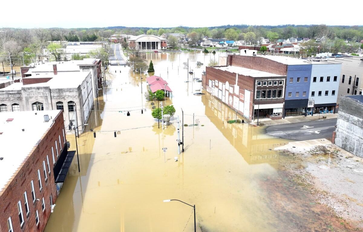
In March, storms with 80 mph winds came through the area just weeks after historic flooding overtook Hopkinsville and Oak Grove. During the flood in early April, 150 homes were impacted resulting in an extended recovery for residents and the city. Over 20 inches of rain fell this spring, with normal precipitation gauging around 13 to 15 inches for the county.
As spring wrapped up in May, an EF-2 tornado touched down in southern Christian County. That same storm took the lives of nearly 20 Kentuckians in Laurel, Pulaski, and Russel County.
Looking at just May, temperatures were cooler than normal with regard to peak temperatures. NWS in Paducah says it was the first May since 2003 in which temperatures failed to exceed 85 degrees in the western Kentucky cities of Paducah and Cape Girardeau.
Looking ahead to summer, NWS is predicting a 33-40% chance that temperatures will lean higher than normal in June, July, and August.
| DON’T MISS A STORY: Click here to sign up for our free weekly email newsletter