

HOPKINSVILLE, KY (CHRISTIAN COUNTY NOW) – This will be a stormy and hot week in Christian County, with a nearly daily chance of showers and thunderstorms.
The heat index will stay in the triple digits for the majority of the week. The National Weather Service in Paducah is predicting that Thursday will bring the most extreme temperatures, with the head index rising to 106.
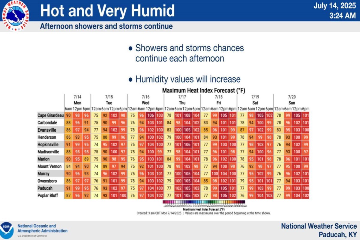
Christian County forecast
Here’s the day-by-day outlook.
Today: A 50 percent chance of showers and thunderstorms. Partly sunny, with a high near 90. Calm wind becoming west southwest around 6 mph in the morning.
Tonight: A 20 percent chance of showers and thunderstorms before 1am. Partly cloudy, with a low around 72. Light and variable wind.
Tuesday: A 50 percent chance of showers and thunderstorms, mainly after 1pm. Mostly sunny, with a high near 92. Calm wind becoming south southwest around 6 mph in the afternoon.
Tuesday night: A 20 percent chance of showers and thunderstorms before 1am. Mostly cloudy, with a low around 72. Light south wind.
Wednesday: A 40 percent chance of showers and thunderstorms. Mostly sunny, with a high near 93. Calm wind becoming southwest 5 to 7 mph in the morning.
Wednesday night: Mostly clear, with a low around 74. Southwest wind around 5 mph becoming calm in the evening.
Thursday: A 40 percent chance of showers and thunderstorms. Mostly sunny, with a high near 94. South southwest wind 3 to 7 mph.
Thursday night: A slight chance of showers and thunderstorms after 1am. Partly cloudy, with a low around 74. South wind around 5 mph becoming calm in the evening.
Friday: A chance of showers and thunderstorms. Partly sunny, with a high near 91. Southwest wind 3 to 7 mph.
Friday night: A slight chance of showers and thunderstorms before 1am. Mostly cloudy, with a low around 74. Light south wind.