

HOPKINSVILLE, KY (CHRISTIAN COUNTY NOW) – Beginning on Friday, severe storm chances for the region increase going into Easter weekend. On Friday and Saturday, large hail and damaging winds will be the main possible threats, with the tornado risk increasing on Sunday.
Severe weather maps show that Hopkinsville is right on the edge of predicted storms, a more detailed outlook will be available as the weekend approaches. The current forecast is showing a chance of storms scattered through Friday, Saturday, and Sunday.
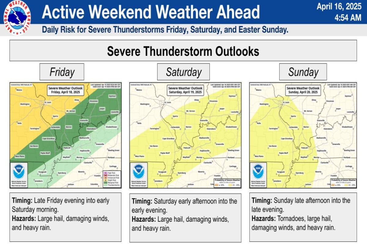
Currently the region has 50-70% chance of seeing one inch of rain Friday through Sunday and a 20-40% chance of seeing more than two inches of rain, according to the National Weather Service in Paducah. Despite the incoming rain, this should not cause widespread flooding on top of existing high water.
“Rainfall wise the current forecast amounts and locations of rainfall do not look like they will significantly worsen our river flood situation,” said a statement from NWS Paducah. “Slowing the current falling appears to be the most likely outcome.”
| WEATHER OUTLOOK: Click here for Christian County’s weather forecast and live radar.