

Update, 9:40 p.m.: The severe storms have moved past Christian County and the warning has been canceled.
Update, 9:15 p.m.: The warning has been extended until 10 p.m.
Update, 8:50 p.m.: A Severe Thunderstorm Warning has been issued for Christian County until 9:30 p.m.
At 8:41 p.m. severe thunderstorms were located along a line extending from near Birmingham Ferry Recreation Area to near Turkey Bay to 7 miles east of Murray, moving east at 55 mph.
Hazards include 70 mph wind gusts and quarter size hail. Hail damage to vehicles is expected. Expect considerable tree damage. Wind damage is also likely to mobile homes, roofs, and outbuildings.
Previously:
HOPKINSVILLE, KY (CHRISTIAN COUNTY NOW) – Rain and storms are predicted throughout the weekend, with possible severe weather developing into Sunday.
A few thunderstorms are predicted for Saturday afternoon and overnight, with heavy rainfall and lightning anticipated, according to the National Weather Service in Paducah. The severe weather risk rises going into Sunday, with widespread storms blowing through the area. Sunday afternoon, tornadoes, large hail, and damaging winds are possible.
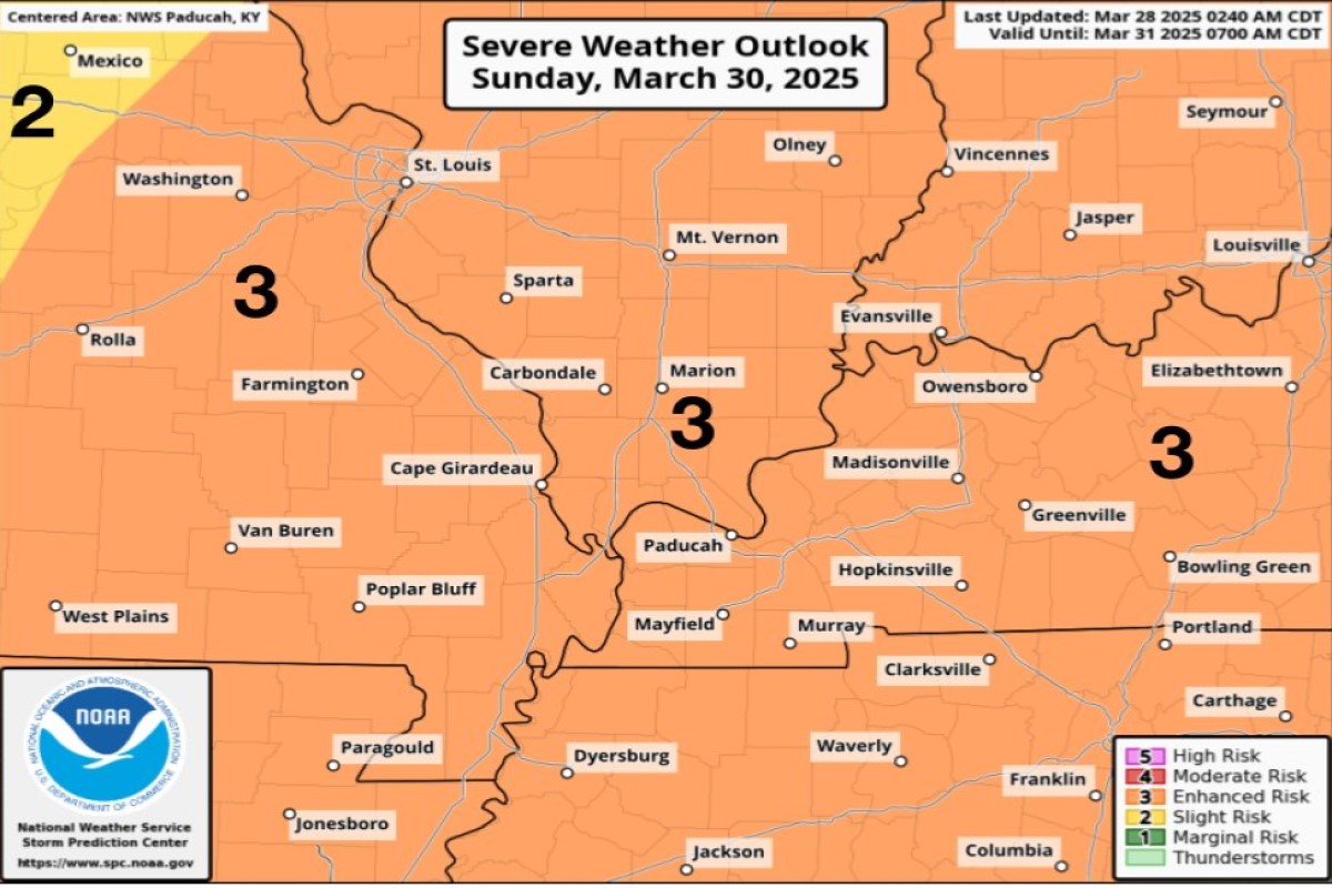
“The severe weather threat level has increased for Sunday with all modes of severe weather possible,” said a statement from NWS Paducah. “Late afternoon into the overnight hours Sunday is expected to be the main time period for severe weather; however, this may change over the next day or two.”