

HOPKINSVILLE, KY (CHRISTIAN COUNTY NOW) – An Extreme Heat Warning has been issued through Tuesday night, along with a Heat Advisory in place until noon on Monday.
The heat index is expected to peak at 112 degrees over the next two days, according to the National Weather Service in Paducah. A cold front will bring a chance of storms Wednesday night, which may be severe. The incoming front will drop temperatures to the 80s.
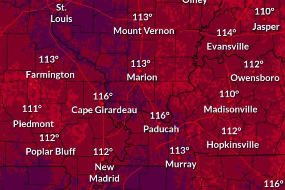
Christian County forecast
Here’s the day-by-day outlook.
Today: A 30 percent chance of showers and thunderstorms, mainly between 1pm and 4pm. Mostly sunny, with a high near 95. Heat index values as high as 112. West wind 3 to 6 mph.
Tonight: A 10 percent chance of showers and thunderstorms before 7pm. Partly cloudy, with a low around 76. West northwest wind around 5 mph becoming calm in the evening.
Tuesday: A 20 percent chance of showers and thunderstorms after 1pm. Mostly sunny, with a high near 95. Heat index values as high as 110. Calm wind becoming north around 6 mph in the afternoon.
Tuesday night: Mostly clear, with a low around 76. Calm wind.
Wednesday: A 40 percent chance of showers and thunderstorms after 1pm. Mostly sunny, with a high near 95. Calm wind becoming northeast around 5 mph in the afternoon.
Wednesday night: A 40 percent chance of showers and thunderstorms. Partly cloudy, with a low around 74. Light east wind.
Thursday: Showers and thunderstorms likely, mainly after 1pm. Partly sunny, with a high near 88. Calm wind becoming north 5 to 7 mph in the morning. Chance of precipitation is 70%.
Thursday night: A chance of showers and thunderstorms, mainly before 1am. Mostly cloudy, with a low around 70. North northeast wind around 6 mph.
Friday: A chance of showers and thunderstorms. Mostly sunny, with a high near 83. North northeast wind 6 to 11 mph.
Friday night: Mostly clear, with a low around 64. Northeast wind 6 to 9 mph.