




Updated 1:15 p.m. The National Weather Service has issued a Severe Thunderstorm Watch for Christian County until 9 p.m. ahead of possible storms.
Previously:
HOPKINSVILLE, KY (CHRISTIAN COUNTY NOW) – Severe storms are possible throughout the area, as a cold front brings in unsettled weather to the region.
The National Weather Service in Paducah says Hopkinsville and Christian County are currently at a slight risk of severe weather Tuesday afternoon. Showers and thunderstorms are anticipated between 12 p.m. and 7 p.m. as a strong cold front comes through.
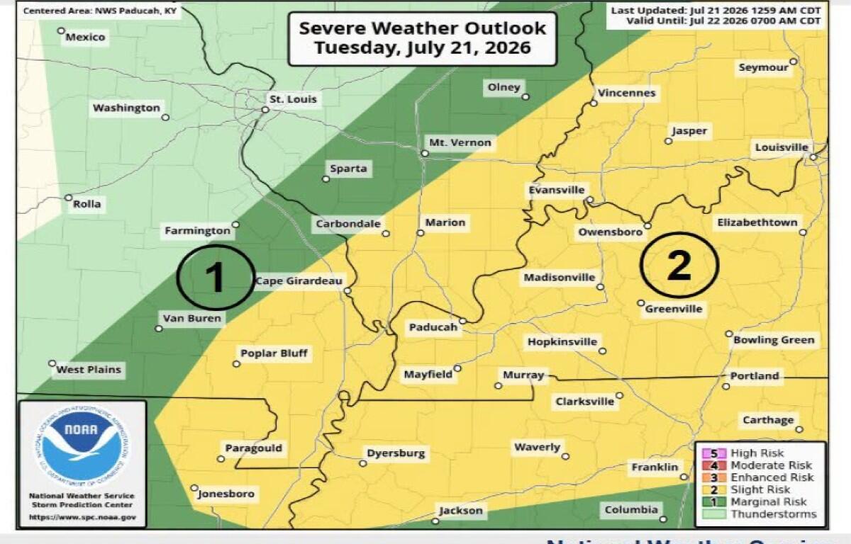
The main threats are damaging winds up to 70 mph, hail and a low-end tornado threat.
An Extreme Heat Warning remains in effect through 7 p.m. on Tuesday as heat index values are anticipated to reach between 110 and 116 degrees. Vulnerable populations such as those who are pregnant, children and elderly people should use caution when outside. NWS also reminds people to not leave pets in hot cars unattended.
Going into Wednesday, much cooler temperatures are immediately expected with highs in the mid to low 80s for the remainder of the week.
| DOWNLOAD THE APP: Sign up for our free Christian County Now app